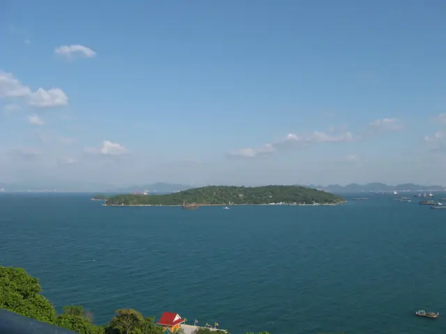
Kaeng Tana National Park gives a different perspective on Ubon Ratchathani's river country: the Mun dividing around an island, reuniting among large rocks and continuing toward its meeting with the Mekong. A first visit works best when you choose one accessible river view and one walk that suits the day's conditions. The suspension bridges and Don Tana island are important parts of the park, but their current access should be checked before they become the sole reason for a long journey.
Give the park a half-day place in an eastern Ubon itinerary if you want time to arrive, ask about the open routes and sit with the river landscape. A shorter visit can still be worthwhile from Khong Chiam. The key is to know which entrance or riverbank you are travelling to and to leave room for a change of plan if water or maintenance affects the route.
Understand which river you are looking at
The celebrated rapids are on the Mun River. This matters in a region where many attractions are advertised through the Mekong. The Department of National Parks explains that the Mun separates around Don Tana, then comes together again among the large rocks at Kaeng Tana. The island and the rapids belong to one river arrangement, rather than being unrelated stops with similar names.
Begin by looking for that spatial relationship. Where is the island relative to your bank? Which direction does the visible channel lead? Can you identify the large rock masses interrupting the flow? You do not need to approach the water's edge to make the scene intelligible.
The wider national park includes low hills, sandstone surfaces, woodland and other streams. Its main DNP page lists attractions across more than one part of the protected area. An attraction appearing in that inventory does not mean it is within a short walk of the headquarters or reachable from the same parking place.
Separate the Mun rapids visit from a plan to see the Mun–Mekong confluence at Khong Chiam. They can form a useful pair, but they are different viewpoints and involve a separate journey. That distinction will help when you brief a driver and when you describe the photographs afterwards.
Choose the correct approach before setting out
The DNP places the park approximately ninety kilometres from Ubon Ratchathani and describes approaches through Phibun Mangsahan, Sirindhorn and Khong Chiam. Its directions also distinguish the park headquarters approach from access on the other side of the river. Use them as an orientation to the road network, then confirm the appropriate entrance for your intended walk.
For a headquarters visit, the official route through Khong Chiam continues toward Ban Nong Chat on Highway 2173 and turns onto Highway 2296. Another approach described by the park uses roads through Sirindhorn. A map search that simply selects the nearest point labelled Kaeng Tana may deliver you to a different bank from the one you expected.
When arranging a vehicle, state the specific goal: visitor centre and currently open island walk, or a permitted river viewpoint on the advised side. Ask the park which location fits that goal. Send the confirmed pin to the driver rather than relying on the park's broad boundary on a map.
Do not promise a precise driving time from Ubon solely from the distance. Leaving the city, stopping for a meal and taking a different river crossing can change the day substantially. From Khong Chiam, the trip is more local, but the correct bank and last road still matter. A reliable return vehicle is especially useful when a walk finishes at a different time from the original estimate.
Start at the visitor information point
A short conversation on arrival can resolve the most important decisions. Ask which bridge sections, island paths and riverside viewpoints are open that day. Explain the walking ability of your group and how long you want to spend outside. Ask for a route that brings you back to your vehicle without an unplanned road transfer.
The park's attraction list includes Don Tana, the suspension bridges, Lan Pha Phueng, Tat Ton waterfall, caves and an inscription site. Treat that as a menu for discussion. It is not a single ready-made circuit, and the visitor centre should help distinguish a short local walk from a separate drive or a more demanding outing.
If the bridge or island route is unavailable, ask for the best open bank-side view of the river and rocks. That alternative preserves the main geographical subject of the visit. It is better to make the decision before walking toward a closed section than to spend the available time retracing an unsuitable route.
Keep a photograph of any route board and remember the agreed turning point. Phone reception listed by the park is useful background, but a signal is not a substitute for knowing where you are going or arranging your pickup. Download the approach map before leaving your accommodation.
What the suspension bridges add
The local authority describes two suspension-bridge spans linking the riverbanks with Don Tana. The steel-supported structures use large cables and a deck over the Mun. Their value is both practical and visual: they connect the island and let visitors see the channels from above, when access is permitted.
For travellers comfortable with the crossing, pause only where doing so leaves space for others. A bridge is a shared route rather than a private photo platform. Keep bags secure and follow all posted instructions about movement, loading and closed sections. Let the river view unfold as part of the crossing instead of concentrating solely on a picture taken over the side.
Anyone uneasy with height or movement should decide before starting. A bank-side viewpoint can still explain the island and the river's divided course. There is no requirement to complete a bridge crossing to make the park visit worthwhile, and companions can agree a meeting place rather than pressuring everyone into the same route.
Ask specifically about step changes, deck surfaces and the approach if anyone uses a mobility aid. A description such as pedestrian bridge does not establish that the whole route is accessible. The approach to the span, the crossing itself and the paths beyond it need to work together.
Let the water level determine the view
The river is an active part of the landscape. Depending on the conditions, exposed rocks, channels and moving water can present a very different scene from an older photograph. A broad bright rock platform in one season may not be an available visitor surface on another date.
Choose a permitted viewpoint and spend time noticing how water moves around the larger forms. Look for the differences between a quiet-looking margin and the main channel without treating either as a bathing invitation. The purpose of this visit is to see the river, and there is no need to enter it to appreciate the rapids.
The DNP describes a monsoon climate, with a wetter part of the year and seasonal changes in the vegetation. That broad pattern is useful for expectations, but it does not predict access on a particular morning. Recent rainfall and local instructions are more useful than a general best-month list when choosing a walking route.
For photography, include enough of the bank or island to explain scale. An image filled entirely with water and rock texture can be attractive but hard to identify later. One overall frame, one view showing the channel arrangement and one closer detail make a clearer record of Kaeng Tana than many near-identical shots taken from an unsafe edge.
Notice the woodland beyond the rapids
The park's ecological account identifies dry dipterocarp forest as widespread, with more limited evergreen forest associated with particular wetter areas. This helps explain why a first impression of open woodland can differ from the dense tropical forest some visitors imagine before arriving.
On an approved short path, look at the relationship between exposed rock, soil and tree cover. The river margin and a drier inland patch can feel quite different over a modest distance. A guide or ranger can help connect what you see with the park's habitat descriptions without turning the walk into a search for an animal that may never appear.
The DNP lists birds and other wildlife recorded in the protected area. A species list is not a promise of sightings beside the visitor centre. Carry binoculars if you enjoy watching birds, keep the group quiet and let any encounter happen on its own terms. A brief view of common river or woodland activity can be more useful than chasing an advertised rare species without local advice.
Keep food and litter contained and stay on the currently permitted route. In this setting, the most revealing details may be the changing shade and the position of vegetation beside the channels. You can appreciate those even if the day produces no conspicuous wildlife sighting.
The inscription adds a historical layer
Kaeng Tana is not only a natural-history destination. The DNP records an inscription associated with Chitrasena, also known by the royal name Mahendravarman, found beside the Mun near the mouth of Lam Dom Noi in 1991. Its account describes Pallava script, Sanskrit language and a text relating to victory and Shaivite religious images.
That record supplies a connection between the river landscape and early political and religious history in the wider Chi–Mun region. It should not be turned into a promise that you can inspect the original stone during an ordinary riverside stroll. Ask the park about the current interpretation and access associated with the findspot, and where the relevant evidence can be seen or studied.
For a first visit, the useful question is how rivers connect landscapes and human activity. The inscription provides a specific historical point to consider while looking at the Mun, rather than an excuse to assign an ancient story to every visible rock. Readers with a strong archaeological interest can follow the DNP record after the visit and plan any separate collection visit deliberately.
Build a realistic half-day outing
An indicative plan begins with fifteen to twenty minutes for arrival, information and deciding the open route. Allow an hour or more for the selected river view and a manageable return walk, adjusted to heat, bridge access and the group. Leave a further margin for a rest, photographs and the drive out. These are flexible allowances rather than an official trail duration.
If you are based in Khong Chiam, pair the park with a meal and one other local subject, such as the confluence, rather than filling every remaining hour with drives. If you start in Ubon, account for both long road legs before adding Pha Taem or another national park. The wider region deserves more than a succession of rushed arrivals.
Bring water, sun protection and shoes with a secure sole. A light rain layer can be useful in unsettled weather. Confirm opening, admission and the exact route with the park before departure; the DNP lists 045 252 722–3 for enquiries. Tell your driver where to wait and keep enough daylight for the return road. With those choices settled, Kaeng Tana offers a clear and memorable subject: the Mun shaping a visit around an island, rock and changing water.
Sources and related planning
- Department of National Parks Kaeng Tana National Park visitor information and road approaches
- Department of National Parks explanation of Kaeng Tana rapids and Don Tana island
- Kham Khuean Kaeo local authority Kaeng Tana suspension-bridge information
- Department of National Parks Chitrasena inscription record
- Tourism Authority of Thailand Kaeng Tana National Park visitor information
- Tripnatic Thailand destination planning